
Waterford Township ZIP Code Coverage
Waterford Township's core postal labels are 48327, 48328, and 48329. They identify broad west or southwest, central or east, and north or east portions of the township in the research record. They are useful starting points, not parcel boundaries. The official state map also notes 48330 as Drayton Plains PO Box Only. Edge labels 48346 and 48324 appear near Waterford, but exact Waterford parcel coverage for those labels was not verified in official sources. USPS address lookup remains the final assignment check for a particular delivery address.
| ZIP | Areas Covered | Post Office | Notes |
|---|---|---|---|
| 48327 | Waterford Township west and southwest portions; Waterford addresses | Verify by USPS street-address lookup | Standard Waterford ZIP, not a township boundary. |
| 48328 | Waterford Township central and east portions; Waterford addresses | Verify by USPS street-address lookup | Exact parcel line requires address verification and map context. |
| 48329 | Waterford Township north and east portions; Waterford addresses | Verify by USPS street-address lookup | Standard Waterford ZIP used in township materials. |
| 48330 | Drayton Plains postal label | Drayton Plains, PO Box Only | Do not treat as a complete residential land-area ZIP. |
| 48346 | Nearby Clarkston edge label | Clarkston-area delivery | Exact Waterford parcel coverage was not verified. |
| 48324 | Nearby West Bloomfield edge label | West Bloomfield-area delivery | Exact Waterford parcel coverage was not verified. |
Postal geography and legal geography have different roles. A mailing ZIP organizes delivery, while a township line determines the jurisdiction named in township and county records. Do not infer that every address with a nearby postal label lies in the same municipality, or that every parcel in Waterford Township shares a single ZIP. Note: Treat the coverage table as orientation, then verify an exact address through USPS before relying on a mailing ZIP.
Waterford Township USPS ZIP Checks
The USPS ZIP Code Lookup is the final address-to-ZIP check. Enter the complete address before opening a parcel record, requesting a geographic file, or comparing a postal label with a historic source. The research did not capture the live form's exact control set, so this is not a claim that USPS supplies a resident list or a ZIP-wide export. Its role here is narrower and important: confirm the delivery ZIP for the specific street address in hand.
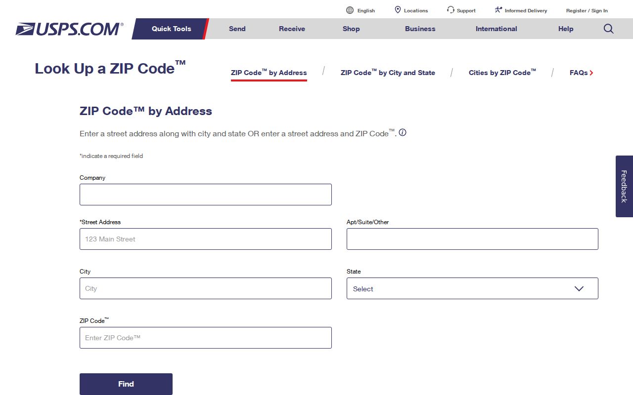
The USPS screen is an address-verification step. After it resolves the ZIP, preserve the address exactly as returned and compare it with the situs address shown in the Waterford or Oakland property records.
Waterford Township ZIP Code Directory Workflow
A postal code narrows an address question, but it does not create a complete directory of people. Waterford's recorded workflow is address first, then parcel and geographic context. The township BS&A landing page exposes Address, Name, and Parcel Number rather than a ZIP field. Oakland County Property Gateway primarily documents Property Address and PIN modes. Michigan's Qualified Voter File request form organizes geographic scope by state, county, city or township, district, school, village, or ward and precinct, not by a promised ZIP search.
- Verify the exact street address through USPS and copy the returned ZIP.
- Use the situs address or PIN in Oakland County Property Gateway or Waterford GIS.
- Record the legal municipality, county, mailing ZIP, and owner mailing ZIP separately. A mailing address can differ from the parcel's situs.
- For a geographic public-record request, use the QVF form's jurisdiction or precinct scope, or send a specific township or county Michigan Freedom of Information Act request. Ask the custodian whether ZIP can be a search parameter.
- Only pair the result with a historic directory after checking that volume's Pontiac or North Oakland geographic scope.
When the ZIP has narrowed the task to a particular street, the Waterford Township streets record path supplies the address-by-address method. Do not read a postal code as a guarantee that an official portal can filter, list, or export every address carrying that code.
Waterford Township Parcel Search Fields
Property Gateway is an address and PIN tool, not a documented ZIP-wide people search. The official interface permits partial and wildcard searching and map navigation after a parcel is located. That makes it useful for testing a confirmed address and seeing parcel context. It does not support a claim that a ZIP filter returns every Waterford Township parcel or resident. Waterford GIS likewise advertises property values, lakes, parks, printable maps, and county map links, while the documented parcel workflow begins with a property address or PIN.
| Field or control | Documented use |
|---|---|
| Property Address | Address mode requires text. The portal specifies at least five characters and gives partial examples such as 1200 S and 123 S V. |
| Address wildcard | Documented examples include 1% Main and 1% S% M. |
| PIN | PIN mode accepts a partial example of 1401100, wildcard 14011%, and multiple comma-separated PINs. |
| Search mode and map | Choose Property Address or PIN, then use map navigation or click a property for parcel context. |
Waterford BS&A provides a separate route for address, name, and parcel searches, including building-department records. Its static landing page does not document a ZIP field. Note: A ZIP may appear within an address string, but the documented Property Gateway search modes remain address and PIN.
Waterford Township ZIP Boundary Mismatch
ZIP boundaries do not define Waterford Township. The Michigan DTMB map warns that ZIP boundaries are not official and do not coincide with ZIP Code Tabulation Areas. A Waterford Township parcel can have a Waterford, Drayton Plains, Clarkston, or West Bloomfield postal label while its legal township boundary is determined by a different record. A ZIP shown in a township survey or map may touch the township, cover a box service, or reach across a municipal line.
- ZIP
- A Postal Service delivery code used to route mail. It is not a legal township or parcel boundary.
- ZIP+4
- An added delivery segment used with a ZIP to refine mail routing for a particular address or delivery point.
- PO Box ZIP
- A ZIP assigned to a post-office box service. Waterford's 48330 Drayton Plains label is marked PO Box Only in the research.
- Carrier route
- A mail-delivery grouping that can help organize delivery, but does not establish a municipal boundary or a complete public-record list.
The practical comparison is simple: use USPS for the delivery code, the assessor and Property Gateway for the parcel, and the township or county custodian for the legal jurisdiction. Those fields can agree, but they should not be assumed to mean the same thing.
Waterford Township ZIP Edge Labels
48346 and 48324 are useful caution labels. The official lower-peninsula map shows Clarkston and West Bloomfield area codes near Waterford, yet the researched sources did not verify exact Waterford parcel coverage for either. They belong in a ZIP code directory because readers can encounter them at the township edge, but they do not support a claim that they are standard Waterford Township residential ZIPs. The same caution applies to 48330: its Drayton Plains label is historically meaningful, but the map's PO Box Only note limits what can be inferred from it.
Verify the individual address, then check the jurisdictional record. A postal city name can preserve a community identity without proving that the address sits in that community's legal boundary. This distinction is especially important along roads, lake areas, and municipal edges where delivery lines and township lines are not the same geography.
Waterford Township ZIP Survey Context
The township's 2024-28 Parks and Recreation Plan reported survey respondents by ZIP: 48329 at 43.7%, 48327 at 30.1%, 48328 at 23.2%, other ZIPs at 2.7%, and 48346 at 0.3%. Those figures are a survey-response distribution, not a population count, municipal boundary, or directory total. They show why the three core Waterford labels have local relevance while also showing why a number from a survey cannot establish all addresses within a ZIP.
Read the Waterford Parks and Recreation Plan as context for its questionnaire results. For an address, property, or jurisdiction decision, return to USPS and the official parcel source instead of extrapolating from the percentages.
Waterford Township Postal and Parcel Keys
Keep four location fields separate in a ZIP code directory search. The modern situs address is the street label used by the assessor, USPS, emergency services, and many portals. The owner mailing address is a tax-correspondence destination and may be outside Waterford Township. A parcel, PIN, or Sidwell number is the property key that connects assessment, mapping, tax, deed, and legal-description records. The legal description, such as a lot and block or metes-and-bounds language, is often the more stable link when roads change names.
| Location key | What it establishes |
|---|---|
| Situs address | Where the parcel is physically located for property and map records. |
| Mailing ZIP and address | How tax notices or other correspondence may be routed; it does not prove occupancy at the situs. |
| PIN or parcel number | The numeric property key that links map, assessment, tax, deed, and legal-description material. |
| Legal description | The lot, block, condominium, or metes-and-bounds language that can bridge an older road label. |
This comparison prevents a postal label from replacing the property record. It also creates a clean handoff when a current address needs a deed, assessment, or historical-map check.
Waterford Township Historic ZIP Limits
Historic directories predate the modern ZIP view and should be searched by their own place and street vocabulary. Pontiac and North Oakland books can use Pontiac, Drayton Plains, Clintonville, Waterford, or another community label. Waterford has 34 inland lakes, and its historical map vocabulary includes Waterford Village, Windiate Park, and Crescent Lake. The township timeline also says Grand River street became Maple and then Andersonville Road. A modern ZIP will not translate those labels by itself.
Use Waterford GIS Online Mapping, historical maps, the parcel PIN, and the legal description to compare old and current geography. No official comprehensive Waterford street-renumbering year was located. Preserve road directionals, suffixes, old names, and community labels when searching so a postal shortcut does not hide the historical trail. Note: Modern ZIP verification is valuable for current delivery, while historical location work needs dated maps and the exact words used in the source.